
I just realized I never posted any photos here from our run through southeastern Arizona. The skies were hit-and-miss; some hard light, some wispy clouds, and a few moments of perfect conditions.
A few photos are posted on my Vero page (https://vero.co/ldholland) but I took a lot more than have hit Vero.
A few spots we visited were… wow. Just wow. In all good ways.
Dos Cabezas
We drove through one exceptional ghost town, called Dos Cabezas, which translates to Two Heads. It sits along and on both sides of State Route 186 on the route to Chiricahua National Monument. If/when we go back, I want to take some of the side roads. What photos we took were all taken from the main drag. There were several incredible structures and ruins where the light wouldn’t allow a usable photo at all. The rest are enough to give you a taste.
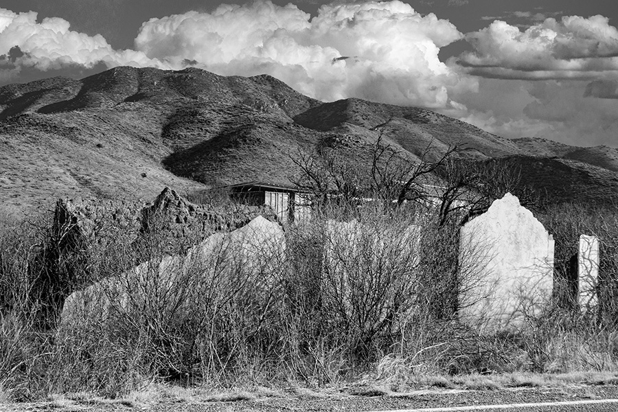
This shows how close these places can be to the highway. The building remains do indeed hug the pavement. A frequent challenge with ghost towns is getting far enough away to get the whole picture, without getting a corner of the photo clipped by another structure. Many of these places were built when the typical transportation was horse and wagon, long before DSLR cameras were a thing.
But hey — at least for places like this, my lack of mobility doesn’t leave me handicapped, so to speak. The perspective isn’t much better on foot. Not to mention, all those brambles boast long thorns. They’re not my idea of a leisurely stroll, anyway.
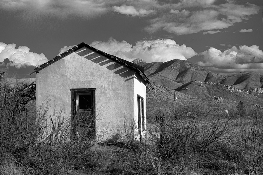
Some structures had more space around them – and were more intact – than others.
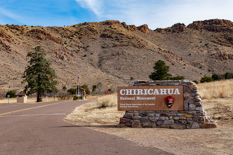
Chiricahuas
We finally made it to the Chiricahuas, too. And like other parts of the state we’ve visited over the past few years, we’ve promised ourselves to go back. It’s an absolutely stunning destination, even sweeter when you consider it’s free to visit. I think it’s even free to camp there, though I would imagine in summer you’d need to reserve space.
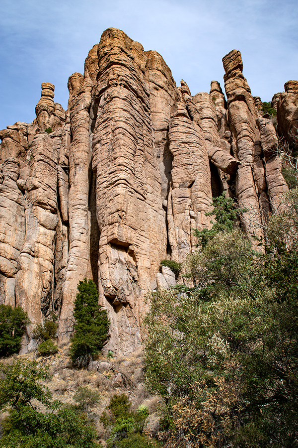
If I remember correctly, the formation above is called the Cathedral. I won’t pretend to remember them all.
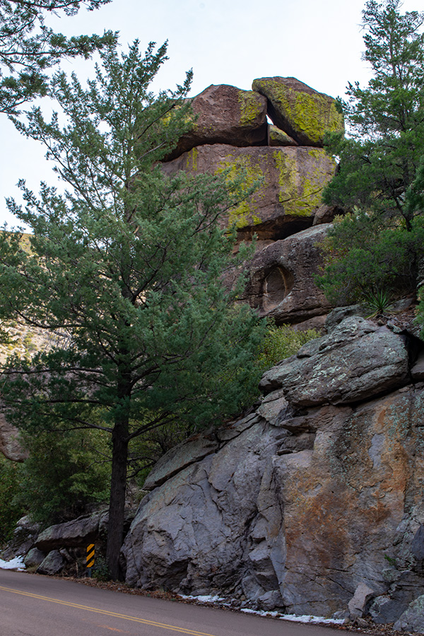
This small formation abuts the roadway. And while it’s tough to tell from these views, the lower elevations are heavily wooded. From the entrance sign, shown at the top of this page, as soon as you drive around the first curve you drive ito a thick forest.
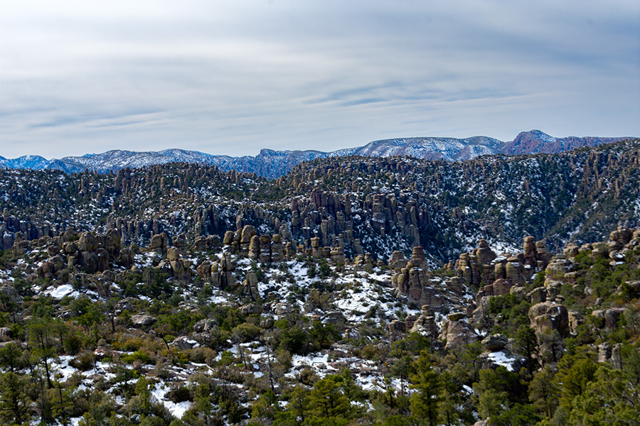
This photo doesn’t do justice to the uppermost overlook. Rock spires dominate the area. The Chiricahuas are less than 100 miles north of the Mexican border. They also rise more than a mile above sea level, though, so yes — snow in February.
Other Ghosty Locales
The second day of our trip was a long double loop. Dos Cabezas was on the way to the Chiricahuas, but we decided to check out some other ghost towns and abandoned locations in the general vicinity. It was hit and miss. A handful of great hits, a few abysmal misses.
Gleeson used to be one of the better-preserved ghost town sites in the state. Sadly, that’s no longer true. The old jail and the old schoolhouse, two of the three best structures to visit in the area, are now on private property, fenced off, and tourist-ified with banners and other garbage, destroying any photographic value. The old store, which still had a roof when we were last there, has now collapsed. A couple of walls remain standing, but I’d expect them to fail in the near future. A few stone foundations still dot the hillsides, along with a couple of collapsed piles of wooden rubble, but that’s about it.
Pearce was more intact, but also touristified. We also drove through too late in the afternoon to get any good photos, and its layout didn’t give me much to work with from the car window. G got a few nice shots I think.
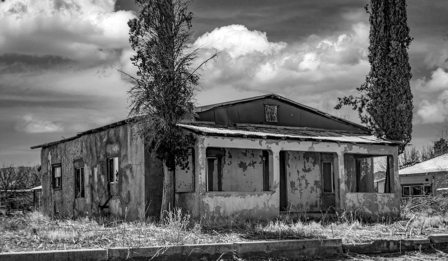
Bowie was a nice surprise. It’s still inhabited, but given how many abandoned buildings we saw, especially along the main drag, I think it qualifies as a ghost town. This isn’t the most spectacular ruined building in Bowie, but it was one we found a couple of blocks off the highway.
A HUGE bust was Fort Bowie, which is separated from the town of Bowie by several miles. Fort Bowie is a designated national historic site. It involves driving down a marginally-marked dirt road, then making a substantial hike to get there. We drove several miles further, to where ostensibly there was a mobility-accessible way in. It meant taking some sketchy-as-hell roads, even by our standards, and there was no accessibility. Zilch. Nada. 0 out of 10, would not recommend.
A few other spots were unmarked. There were walls and foundations rising on hillsides between Pearce and Gleeson, and one more modern abandoned property along a detour. Part of Highway 191 was closed for road construction.
It’s going to take me a while to get through all the photos, but this is a start.